Tuesday, May 24, 2016

Mapping the Unknown

During leg one we took a break from our normal operations to collect some data for our friends and colleagues at the NOAA Office of National Marine Sanctuaries. NOAA is responsible for the conservation and management of over 170,000 square miles of America's most iconic natural and cultural marine resources designated as National Marine Sanctuaries. Sanctuaries seek to preserve the extraordinary scenic beauty, biodiversity, historical connections and economic productivity of our most precious underwater treasures.

Like the United States, every country in the Caribbean has it's own special Marine Protected Areas (MPAs) that they work to conserve for future generations. Cuba is a shining example with 126 Marine Protected Areas and boasting some of the most pristine and healthy coral reefs in the Caribbean.

Map of the newly designated Sister Sanctuaries - Guanahacabibes and Banco de San Antonio in Cuba, and Florida Keys and Flower Garden Banks national marine sanctuaries in the United States.
As you know from previous posts, the Caribbean and Gulf of Mexico are connected by ocean currents. In an effort to conserve our interrelated marine ecosystems, NOAA, the US National Park Service, and Cuba’s Ministry of Science, Technology and Environments signed a memorandum of understanding (MOU) on November 18, 2015 that aims to facilitate cooperation on the science, stewardship and management related to Marine Protected Areas (MPAs). This was a historical agreement between two neighboring countries only recently resuming diplomatic relations. The MOU included a Sister MPA program that recognizes the important connections among the newly designated Sister Sanctuaries - Guanahacabibes and Banco de San Antonio in Cuba, and Florida Keys and Flower Garden Banks national marine sanctuaries in the United States. And the sharing of scientific research and outreach information promoted by this program will hopefully lead to increased protection of our delicate marine ecosystems.

Evolution of bathymetric mapping technology. 
While in the vicinity of Banco de San Antonio, we temporarily pulled in our plankton nets and switched on the multibeam echo sounder to make a bathymetric map of Banco de San Antonio. Bathymetry is essentially "underwater topography" and these maps illustrate the three-dimensional features (relief) of the sea floor. Although this type of work is out of our range of expertise, the crew of the Nancy Foster are experts. Survey Technicians Nick and Samantha have conducted hundreds of miles of mapping and specialize in turning the data collected into beautiful topographic maps. In fact, this type of bottom mapping is the sole mission of many NOAA ships who tirelessly survey the ocean bottom and provide this information to to the general public in the form of nautical charts that allow safe passage to all U.S. ports for both commercial and recreational boaters.

Bathymetric map of  Banco de San Antonio created from Nancy Foster survey data overlaid on a nautical chart, color corresponds to depth (warm=shallow). Charted depths in meters.

Three dimensional closeup of the southeastern portion of Banco de San Antonio. Red bumps likely correspond to coral formations.

The images produced through the Nancy Foster's work will provide information about the habitat and terrain on this very interesting feature that contains high biodiversity, including many species of fish, sponges, and corals. The bathymetric map will direct future research that will use methods such as underwater cameras, SCUBA divers, and possibly ROVs (remotely operated underwater vehicles) to explore in more detail the habitats on Banco de San Antonio.

Mowing the lawn: The Nancy Foster's track can be seen in orange as progress is made during mapping. The speed, direction and spacing of every pass over the bank is crucial to getting the highest quality data and requires an experienced bridge team.
Senior Survey Technician Samantha Martin monitors progress of the Nancy Foster's effort to map Banco de San Antonio.

Monday, May 16, 2016

Finding the Features

A Battle on Many Fronts


Where is the best place to catch fish? Alas, a question that plagues not only the fisherman, but the fisheries oceanographer as well. Ocean conditions and transport mechanisms play a vital role in the lives of the fish (and other creatures) that dwell there. Hours after spawning, ocean currents are sweeping fertilized fish eggs away from their spawning location. If the temperature is just right, the eggs hatch into larval fish where ocean features such as eddies will ultimately determine if the fish will find its favorite food and grow into an adult.

How do we find these ever-changing phenomena so we can study the effect they have on larval fish? Well...we have some tools.

Satellites


You may find it strange that we use satellites orbiting hundreds of miles above the Earth to find habitat for larval fish that can only be examined under a microscope, but it’s true! From the deck of a ship, one patch of blue water often looks like the next, which is why we call on instruments such as the Advanced Very High Resolution Radiometer (AVHRR) to do our sensing. A radiometer is a high-tech piece of equipment mounted on an orbiting satellite that detects radiation which can be used for remotely determining cloud cover, or, in our case, sea surface temperatures. Our collaborators at Roffer’s Ocean Fishing Forecasting Services, Inc. (ROFFSTM) analyze the satellite data to provide us with a picture of where the boundaries between distinct water masses (“fronts”) are. The color image below makes it easy to see the fronts differentiated by surface temperature. 

Satellite image and analysis analysis from ROFFS showing sea surface temperature (SST), currents (blue arrows), completed/planned stations (pink Xs) and future possible sampling locations (red Xs)
We know certain species such as Atlantic bluefin tuna often spawn near fronts, so this helps us in determining where the best areas to sample for larvae are. But satellites have their limitations. Despite the Caribbean’s reputation for sunny beaches, the clouds do occasionally roll in and prevent the satellites from “seeing” the ocean surface.

Circulation Models


While satellites provide accurate, near-real time information, sometimes it is useful to get an estimate of what the future holds. Ocean general circulation models such as the Hybrid Coordinate Ocean Model (HYCOM) use environmental inputs and complex mathematical formulas to produce predictions of ocean parameters such as Sea Surface Temperature (SST) and the speed and direction of ocean currents. 

HYCOM model output for sea surface temperature (degrees Celsius)
HYCOM model output for ocean currents (arrows show direction, colors show speed in cm/second)
While the model is not a perfect predictor, it proves useful on cloudy days or when you want to do some advance planning which is almost always necessary on a ship that has a maximum speed of 10.5 knots (~12 mph).

Ship Data


Having the support of satellites endlessly gathering data and computers constantly running models are great assets to what we do…but so is having access to a high-tech research vessel! Flow through sensors show real-time sea surface temperature and salinity as the ship is sailing and echo sounders are pinging the bottom and displaying a precise depth. But perhaps the most important tool aboard to detect frontal zones is the Acoustic Doppler Current Profiler, also known as the ADCP.  

ADCP output from the 2015 survey across the Yucatan Channel. The ship's track is in black with the direction and size of the arrows showing the direction and speed of the current. Color indicates SST.
The ADCP uses sound waves and the Doppler Effect to measure how fast water is moving in the water column. What does all this jargon mean? It means that we can detect the speed and direction of the current directly below the ship…while the ship is moving! So once we consult the satellite images and model outputs, the ADCP confirms that we have arrived at the right spot. Then it is time to tow some nets…

Saturday, May 14, 2016

Let's get Sampling!

North of Havana, Cuba, the sampling is officially underway! 

One goal of this first leg is to better understand the oceanography around Cuba, especially the northern and western regions. For hydrographic modelers in the U.S. working in the Gulf of Mexico and Straits of Florida, this region is of great interest since access to empirical data from around Cuba has been lacking and these waters are tightly connected to surrounding U.S. waters. One way to visualize this connectivity is through the deployment of satellite-tracked surface drifting buoys ("drifters"). Like a high-tech message in a bottle, the drifter floats along with ocean currents periodically communicating its position and other data such as temperature to passing satellites.


Research Associate Akihiro Shiroza deploys a drifter off of the Nancy Foster in 2015

The image below shows the paths of some drifters deployed off of the Yucatan in Mexico in 2006. As you can see, not all of them ended up in the same place. Some ended up in the Gulf of Mexico, one returned to the Caribbean south of Cuba and the other ended up in the Atlantic following the Gulf Stream! This illustrates how fish spawned in similar areas can end up very far from each other.


Drifter trajectories from a larval study in 2006. Each color represents one drifter. Open circles are start points and stars are end points.
Over the first week of sampling we were able to collect lots of physical data - information about currents, temperature, and salinity - as well as biological samples. These biological, or plankton, samples included tuna larvae and possibly even a couple of bluefin tuna larvae (though, of course, we need to confirm these identifications with genetics once we return to the lab!). These physical and biological data were collected from areas of upwelling to the west of Havana and on the eastern end of Guanahacabibes Peninsula (western-most point of Cuba) and also from a mesoscale eddy located on the western side of the Loop Current.

Plankton collected on NF-16-02. From top left to bottom right: Amphipod, larval anglerfish (Ceratioidei), larval blackfin tunas (Thunnus atlanticus), larval squid, larval lobster, larval lionfish (Pterois volitans)

Areas of upwelling are very important for life in the ocean as the deeper waters that are flowing up to the surface bring with them lots of nutrients. Once these nutrients reach a depth where sunlight can penetrate, they are taken up by phytoplankton to help them grow and reproduce and, thus, primary productivity is increased. These areas of increased productivity are great for zooplankters that eat the phytoplankton. And, in turn, as zooplankton (such as copepods) grow and reproduce, these areas become great for larval fish that each the copepods. Those increases in nutrients move right up the food chain! 

Collecting plankton is hard work! Top: Ofelia, Atsushi, and Aki rinse down the net. Middle: Lulu and Raul prepare the sample for sorting by rinsing out the cod end (grey PVC with holes). Bottom: Lulu and Estrella diligently sort through the plankton, pulling out any fish species of interest.

Mesoscale eddies are also significant oceanographic features for very similar reasons. The dynamic flow patterns associated with eddies include areas of upwelling. In addition to the upwelling, the recirculating nature of the eddy currents can sometimes retain weak-swimming plankton within the eddy feature, and, therefore, near those areas of increased productivity. Mesoscale eddies are found throughout all of the world’s oceans and since the advent of satellite techniques that allow us to observe the ocean over large spatial and temporal scales scientists have begun to recognize that eddies may be critical to much life in the ocean. Our work on eddies on this cruise has just begun……stay tuned for much more in depth sampling of mesoscale eddies on leg 2!

Thursday, May 12, 2016

The FORCES Awaken

NOAA Ship Nancy Foster alongside in Havana, Cuba
The Nancy Foster is underway once again with an eager compliment of scientists ready to comb the Caribbean for plankton! As with last year the Southeast Fisheries Science Center (SEFSC) is partnering with the Atlantic Oceanographic and Meteorological Laboratory (AOML) to tackle this year’s scientific objectives.

The first part of the 2016 survey (NF-16-02) will be working in waters around western Cuba and east of the Yucatan Peninsula. The focus of this part of the survey will be to continue our study of the distribution and abundance of Atlantic bluefin tuna (ABT) and other tuna larvae in the Gulf of Mexico and western Caribbean Sea. In addition to tuna larvae, the 2016 survey will sample other larval species found near regional coastal reefs including snapper, grouper, parrotfish, and spiny lobster larvae. The goal is to understand the role that the major current systems play in the dispersal/retention of these species and identify possible spawning locations, examine growth and survival of larvae, and increase our understanding of species recruitment to benthic habitat.

The second part of the 2016 survey (NF-16-03) will take place in the vicinity of the Virgin Islands (VI). During this part of the survey, we plan on sampling water properties, currents, and dispersal and transport of fish larvae in the VI and neighboring regions. Results from the survey can enhance our understanding of regional spatial variation in the supply of fish larvae between managed and non-managed areas.

The mighty Neuston net soars again
While the research area and sampling methods may seem similar to last year’s project, we can assure you, our loyal reader, that new and exciting things are in store for 2016! One major change that happened since last year is a rebranding of the very lab that brings you this blog. Say goodbye to the SEFSC’s Early Life History (ELH) Lab and hello to the Fisheries Oceanography for Recruitment, Climate, and Ecosystem Studies (FORCES) Lab! During its humble beginnings, the ELH lab was focused on larval fish taxonomy (i.e. the description and classification of larval fishes) but in the years that followed our work has expanded to a point where now we use tools such as biophysical models, genetics, and isotope analysis to look at the role larval fish and plankton play in the ocean ecosystem in an effort to protect and manage our valuable ocean resources.

The first days of any cruise are indeed hectic as the science party begins to regain their sea legs and shake the rust off. As we put our first nets in the water and deploy our inaugural CTDs north of Havana, Cuba, here is a recap of what the Foster has been up to since we embarked in Miami.

Castillo de los Tres Reyes Magos del Morro
NOAA Ship Nancy Foster arrived at the U.S. Coast Guard Base Miami Beach on May 2nd, at which point the controlled chaos began. Scientists and crew worked like ants to load all of the necessary equipment and supplies for almost two months at sea; nets, frames, CTDs, hundreds of sample jars, drums of ethanol, drifters, microscopes, computers, liquid nitrogen, fuel, FOOD! Members of the science party flew in from all corners of the world; Mexico, Spain, Japan… Last-minute generator repairs completed…Amongst the chaos we also managed to host a 6th grade class for a field trip aboard the vessel. Somehow, everything got done and on May 7th, lines were tossed and NF-16-02 and the Nancy Foster were underway! Next stop: Havana.

The day long transit to Havana gave us some time to catch up with each other, (re)familiarize ourselves with the ship, and discuss the upcoming sampling plan. We also took this time to test all of our science equipment. We stopped to deploy our nets and CTD to make sure all of the electronics were functioning properly and went over deployment and recovery procedures (it is a true group effort!).

A Havana icon
The Nancy Foster arrived in Havana on May 8th to embark the last two members of our science party. The crew and science party enjoyed the prestige of being one of the first U.S. Government vessels to pull in to Havana in a very long time. For more pictures and information on the Nancy Foster's visit to Cuba click here, or here.  With our Cuban colleagues aboard, the Foster left Havana on May 10th en route to station 001.  Although the weather was less than ideal, we were hoping that our excitement to get the survey started would soothe our seasickness (but if that doesn’t work, there is always sea sickness medication).


Stay tuned as our exciting 2016 survey unfolds. If this is your first Nancy Foster Chronicle, feel free to browse previous years’ blogs to get an idea of what we are all about!

Clyde keeps a watchful eye on the ship

Friday, June 12, 2015

Today our blog features Lulu from ECOSUR!


Lulu sorting through the microscope
The cruise is finally over!! We pulled into Key West on June 2nd and returned to Miami with our equipment and samples! I will post a few more entries on our cruise-blog....but today our blog will feature a dear colleague of mine: Vásquez Yeomans or “Lulu” who joined the cruise from Chetumal’s ECOSUR (El Colegio de la FronteraSur) where she is a researcher in the Zooplankton Laboratory in the Departamento de Sistemática y Ecología Acuática. 

Lulu and a leptocephalus larva
She shared with the blog that “I identify larval fishes using multiple techniques, from traditional dichotomous and taxonomic keys to the more novel DNA BARCODE technique to identify fish larvae. I also work to update and develop larval distribution and abundance in the Mesoamerican Reef and act as 'advisor' for students doing their Senior and Graduate theses."
noaa research women STEM
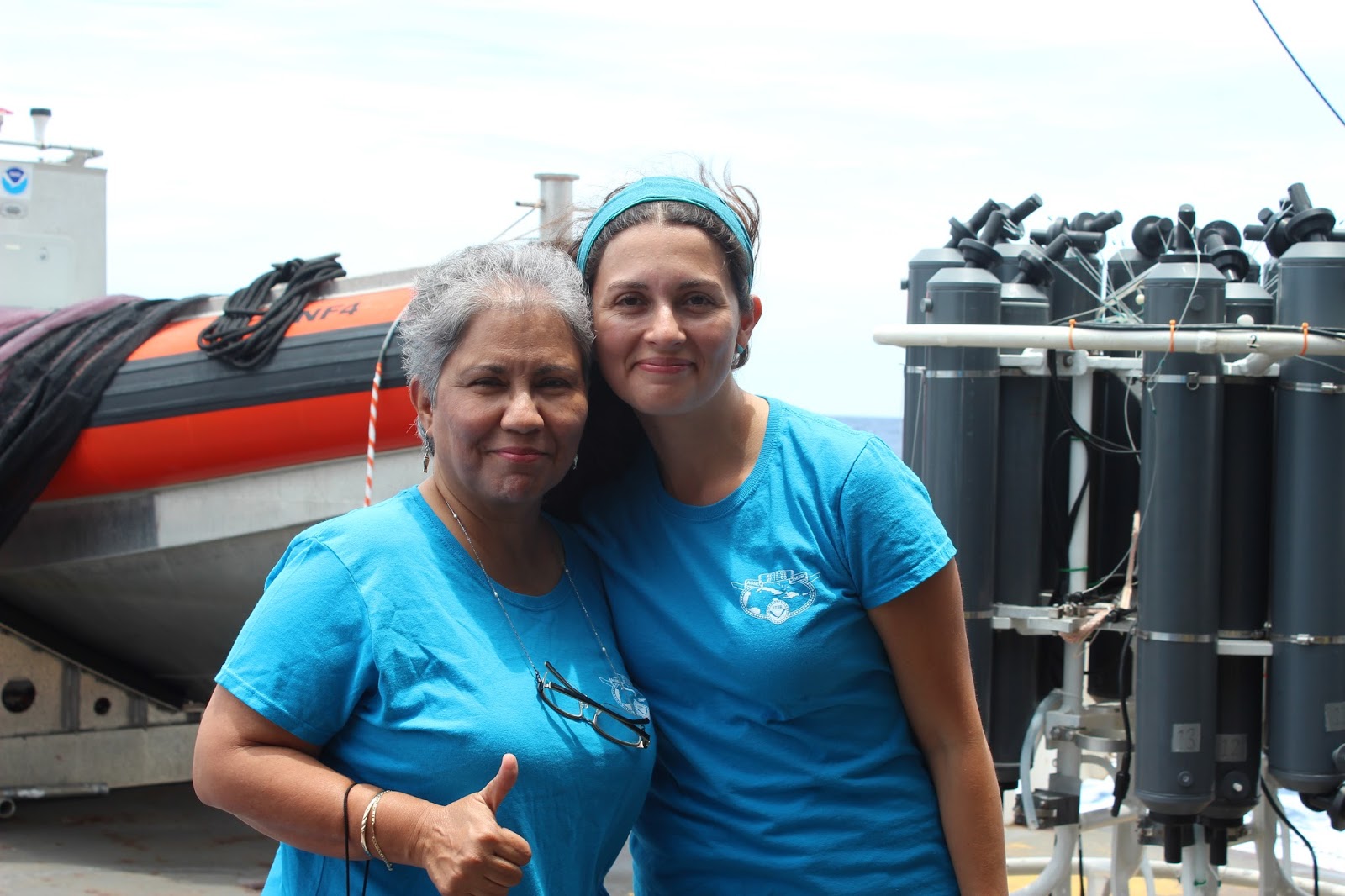
Lulu and Estrella
Although Lulu is an expert at identifying many larval fish groups, Lulu actually joined our survey to improve her skills in the identification of larval bluefin tuna!
Lulu and the MOCNESS in the back deck
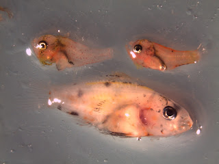
She also was very interested in photo-documenting some of the lovely fish photos we have been featuring in the blog in seawater (before we preserve them in ethanol – and then they lose their color!).

gobiidae reef fish larval fish
Gobiidae

Lulu shared with the blog “I am here to continue our ongoing collaborations (2004-today!) with the NOAA ELH Lab and promote future relationships with the other scientists on board.” In Spanish, Lulu said: "Estoy feliz de estar en este crucero participando directamente en la obtención de muestras muchas de las cuales he podido observar en vivo. Esta es una oportunidad única. Gracias a todos y especialmente a John Lamkin y Estrella Malca.”

We were delighted to have "Lulu" join us in this historic expedition in the Western Caribbean. Here are some photos Lulu took while she was on the ship!
Mixed assortment of reef fish (Apogonid, Serranid)

Mixed assortment

the inspiration from "Alien"